
What is a Contour and Feature Survey
A Contour and Feature Survey is a visual representation of the property. It is the first step when you want to subdivide land, build a dwelling or do an extension.
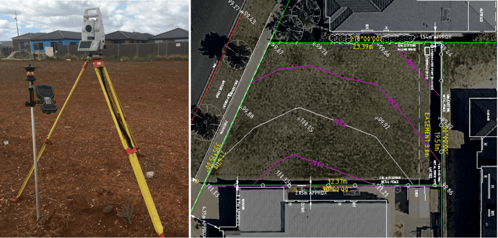
A Feature and Contour survey provides information about existing features within a site such as, trees, the location of fences, ground levels, topography, existing structures, adjoining property building locations, window, ridge and eaves heights, utility services (above, on or below ground), drains, crossovers, etc. The extent of detail a feature survey provides can varies is based on the purpose of the project and council requirements.
Why do you need a Contour and Feature Survey
The two main reasons are design and council approval. It is necessary for architects, building designers, engineers and builders to gain a context of a particular site, to grasp how much site works are required and begin to design the plans of new structures, landscapes, dwellings, etc.
This survey also provides the council with the specific information that is used to assess if building plans meet government requirements.
Why is important the accuracy of the contour and feature survey:
Getting an accurate survey plan is vital if you want to avoid delays and costly mistakes. If the measurements are wrong, all plans and designs will have to be corrected resulting in delays and unnecessary problems. A feature survey is a critical stage as it can set the tone for a project, as such must be carried out with the appropriate professionalism and expertise.
At Intrax we harness the power of modern technology, including GPS, Robotic Total stations and laser scanners, to bring accurate and cost-effective surveying solutions that mitigate risk.
To learn more about our full-service approach or to experience it for yourself, get in touch with the Intrax team today.