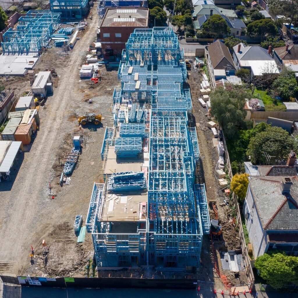
Residential
Residential
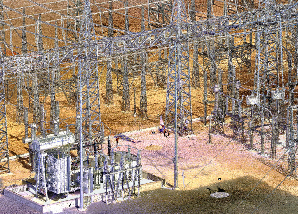
Utilities & Energy
Utilities & Energy
Public & Community
Public & Community
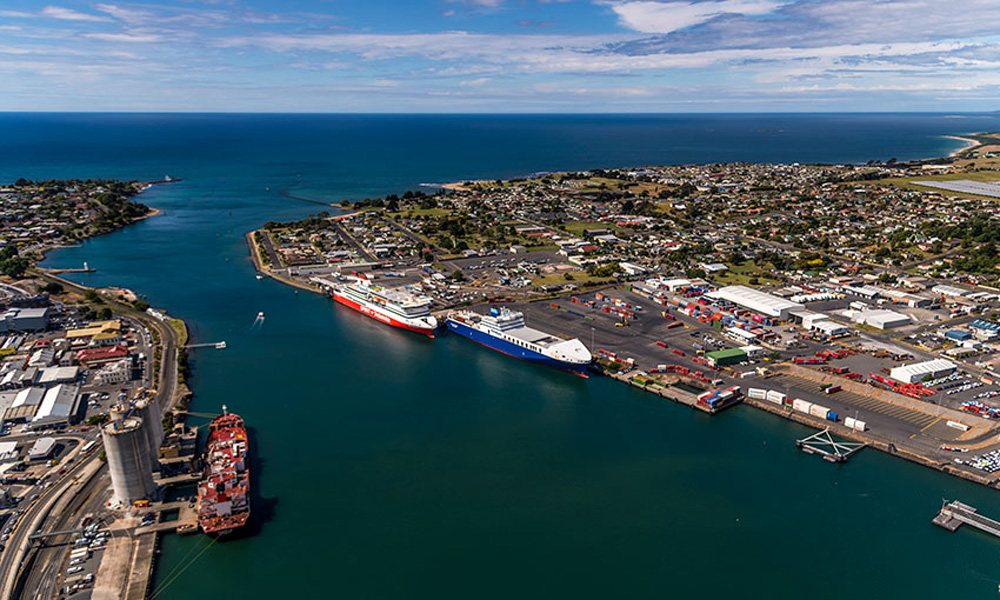
Marine
Marine
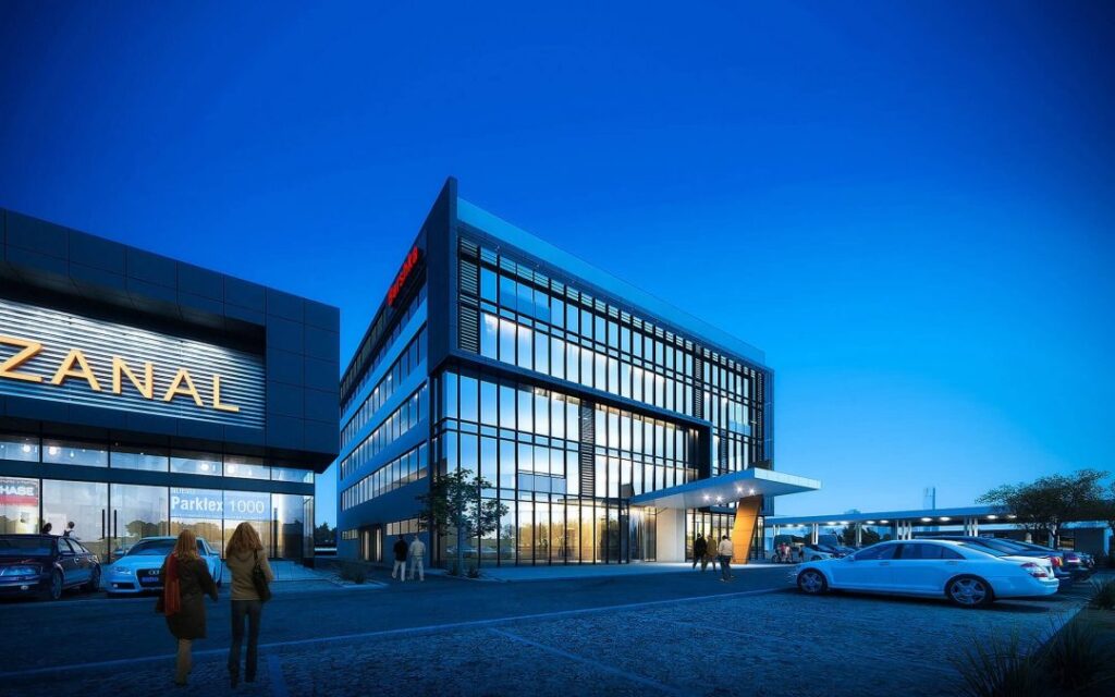
Commercial & High-Rise
Commercial & High-Rise
Infrastructure
Infrastructure
Land Development
Land Development
Environment and Conservation
Environment and Conservation
Defense
Defense
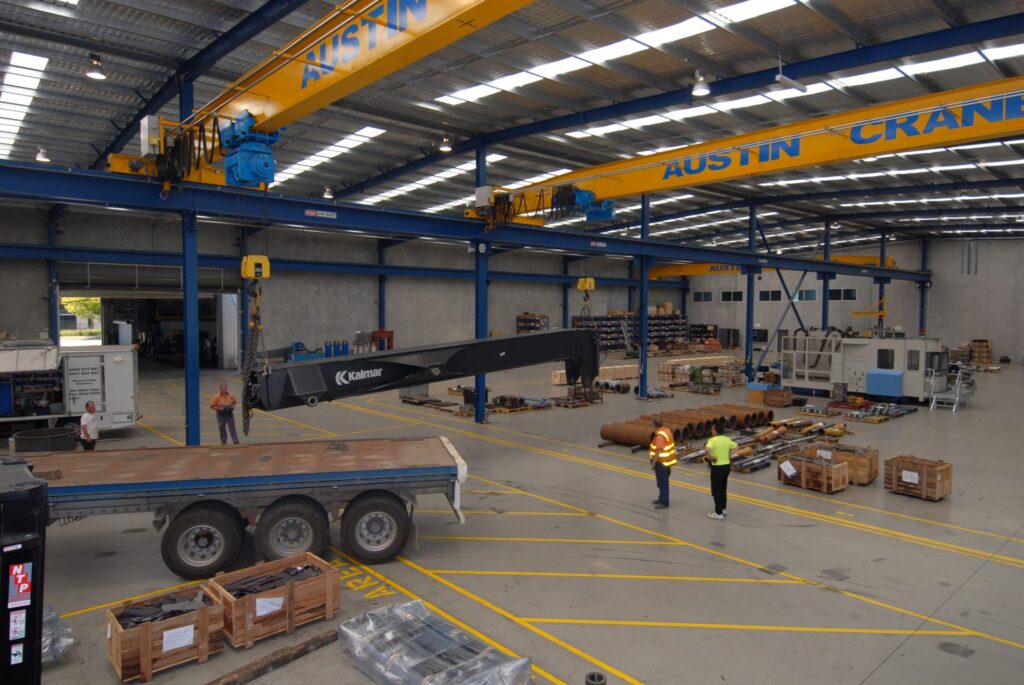
Industrial
Industrial
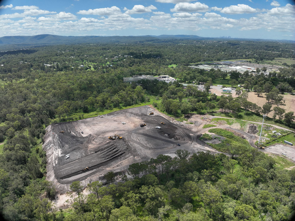
Landfill & Quarries
Landfill & Quarries
Transport
Transport
Recreational & Amusement
Recreational & Amusement
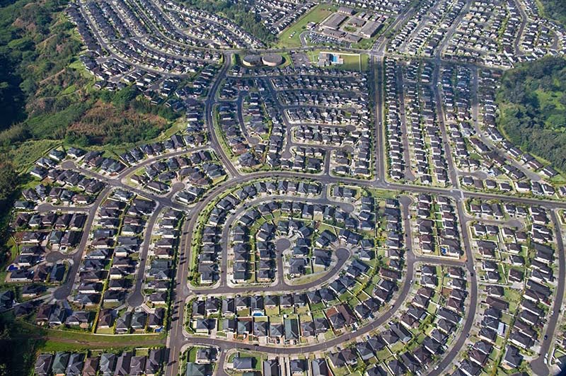
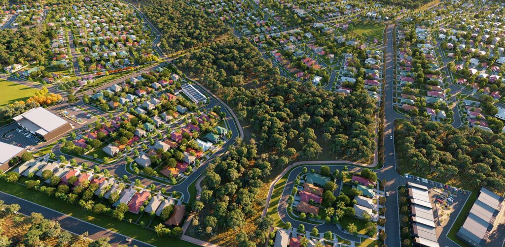
Residential
Intrax Land delivers comprehensive engineering and surveying solutions for residential developments, from subdivisions to master-planned communities. Our multidisciplinary approach integrates geotechnical analysis, civil design and cadastral surveying to optimise land use and ensure compliance with local regulations. Using GIS mapping and 3D laser scanning, we provide precise site data, reducing risks and accelerating approvals. Our NATA-accredited lab supports reliable soil testing, while our national reach ensures consistent quality service across urban and regional sites, delivering cost-effective, sustainable outcomes for developers and homeowners.
Commercial & High-Rise
Intrax Land supports commercial and high-rise projects with tailored geotechnical, surveying and civil engineering services. From office towers to mixed-use developments, our team leverages advanced technologies to deliver accurate site assessments and designs. We provide pavement investigations, slope stability analyses and utility coordination, ensuring robust foundations and compliance with authority requirements. Our integrated approach minimizes delays and optimizes project value, with a single point of contact ensuring seamless delivery across Australia’s metropolitan and regional centers.

Industrial
Intrax Land provides specialized solutions for industrial projects, including warehouses, factories, and logistics hubs. Our services encompass geotechnical investigations, civil design, and surveying, with a focus on pavement design, site classification, and utility infrastructure. Using NATA-accredited lab testing and advanced tools like GIS, we ensure durable, cost-effective outcomes tailored to heavy-load requirements. Our national presence enables rapid mobilization, delivering coordinated, high-quality solutions that reduce risks and support operational efficiency for industrial clients.
Utilities & Energy
Intrax Land supports utilities and energy projects with precise surveying, geotechnical analysis, and civil engineering services. From renewable energy sites to utility networks, we deliver site classifications, seismic investigations, and infrastructure designs that ensure long-term reliability. Our advanced technologies, including aerial surveys and GIS mapping, streamline planning and approvals, while our NATA-accredited lab provides robust material testing. With nationwide expertise, we offer coordinated solutions that minimize environmental impact and meet stringent regulatory standards.
Infrastructure
Intrax Land excels in infrastructure projects, delivering surveying, geotechnical, and civil engineering services for roads, bridges, and public works. Our multidisciplinary team uses 3D laser scanning, GIS, and NATA-accredited testing to provide accurate data and designs, ensuring durability and compliance. From conceptual planning to construction surveys, we optimize project timelines and budgets, offering a single point of contact for seamless coordination. Our national reach supports projects in urban and remote areas, delivering sustainable, high-quality infrastructure solutions.
Landfill & Quarries
Intrax Land provides specialized geotechnical and surveying services for landfill and quarry developments. Our team conducts slope stability assessments, material testing, and site classifications, supported by our NATA-accredited lab. Using GIS and drone surveys, we deliver precise data for planning and compliance, ensuring safe, sustainable operations. Our civil engineering expertise supports access roads and drainage systems, while our national presence ensures rapid, reliable service across Australia, minimizing risks and optimizing project outcomes.
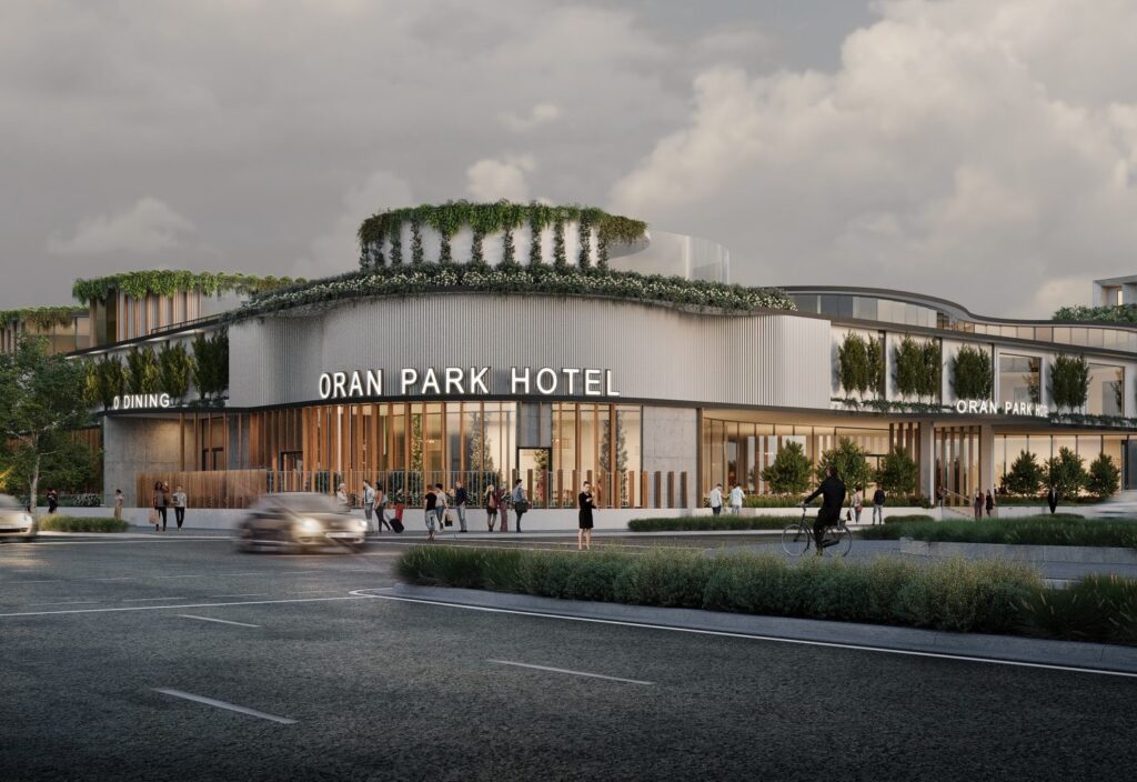
Public & Community
Intrax Land supports public and community projects, such as parks, libraries, and civic centers, with integrated surveying, geotechnical, and civil engineering services. Our team delivers feature surveys, site classifications, and stormwater designs, using advanced tools like 3D laser scanning to ensure accuracy. We prioritize cost-effective, sustainable solutions that meet community needs and regulatory requirements. With a national network, we provide consistent, high-quality services, ensuring timely delivery and stakeholder satisfaction across urban and regional sites.
Land Development
Intrax Land drives land development projects with end-to-end surveying, geotechnical, and civil engineering services. From lot yield planning to construction surveys, we optimize site potential while ensuring compliance with council requirements. Our GIS mapping, drone surveys, and NATA-accredited testing provide accurate, reliable data, reducing risks and accelerating approvals. With a national presence, we deliver coordinated, cost-effective solutions for developers, ensuring sustainable, high-value outcomes across residential, commercial, and mixed-use projects.
Transport
Intrax Land supports transport infrastructure, including roads, rail, and airports, with surveying, geotechnical, and civil engineering expertise. Our services include pavement design, slope stability assessments, and construction surveys, backed by GIS and 3D laser scanning for precision. Our NATA-accredited lab ensures reliable material testing, while our national network delivers consistent, timely solutions. We provide coordinated designs that enhance safety and durability, meeting the unique demands of transport projects across Australia.
Marine
Intrax Land delivers specialized solutions for marine projects, such as ports and coastal infrastructure, with geotechnical, surveying, and civil engineering services. Our team conducts seismic investigations, salinity assessments, and cadastral surveys, using drone and GIS technologies for accurate data. Our NATA-accredited lab supports robust material testing, ensuring durable designs. With nationwide expertise, we provide coordinated, sustainable solutions that meet regulatory and environmental standards, optimizing project outcomes in challenging marine environments.
Environment and Conservation
Intrax Land supports environmental and conservation projects with surveying, geotechnical, and civil engineering services focused on sustainability. Our team delivers land capability assessments, acid sulphate soil testing, and WSUD designs, using GIS and aerial surveys for precision. Our NATA-accredited lab ensures reliable data, while our national reach supports projects in sensitive ecosystems. We provide coordinated, environmentally responsible solutions that balance development with conservation goals, meeting regulatory and community expectations.
Recreational & Amusement
Intrax Land provides engineering and surveying solutions for recreational and amusement projects, such as sports facilities and theme parks. Our services include site classifications, feature surveys, and civil designs, supported by 3D laser scanning and GIS for accuracy. Our NATA-accredited lab ensures durable material selections, while our multidisciplinary approach delivers cost-effective, safe designs. With a national presence, we offer timely, high-quality services that enhance user experience and meet regulatory standards.
Defense
Intrax Land provides secure, reliable engineering and surveying solutions for defense projects, including bases and training facilities. Our geotechnical investigations, seismic analyses, and cadastral surveys ensure robust, compliant designs tailored to stringent security and operational requirements. Using advanced technologies and our NATA-accredited lab, we deliver precise data and coordinated solutions. Our national reach and multidisciplinary approach ensure rapid, high-quality service, supporting defense stakeholders with cost-effective, sustainable outcomes.